The “Silver Taiga” Ecologists Will Assess a Long-term Logging Impact on the Water Resources
Last year, 2014, Komi Regional Non-Profit Foundation “Silver Taiga” started the implementation of a new project – “Assessment of a long-term logging impact on the water resources”. The project coordinator, Silver Taiga Foundation Director Yury PAUTOV, explains why the need for such project has emerged, tells about the challenges in its implementation, and its first results.
– Yury Anatolyevich, the subject declared in the title of the project, is certainly relevant, but why was it necessary to separate it into a separate field of work, a separate project?
– Yes, any educated person, and, indeed, any practitioner, understands that logging affects a landscape, as well as streams and rivers, running through this landscape, but how does it actually influence them? How significant is the impact? Both in Russia and abroad scientists and practitioners have conducted experimental works to find out the degree of such impact. The same research was carried out in Komi in the 80s of the last century on a small watershed of the Maya river – the second-order tributary of the river Vym. It was conducted by the Moscow Forest Design Institute RosGIPROLes. However, it has not been completed due to the beginning of perestroika.
The results of all these studies are widely different, and frequently even opposing. No wonder that there is a saying: the forest growing in the dry regions waters the territory and in the humid – dries it out.
There is one more scientific point of view: no two rivers are alike, therefore, the results of the studies, conducted on one watercourse, may not match the results of the similar studies carried out on another.
When it comes to our republic, it is also important to note that the intensive logging impact on the rivers and watersheds – in respect of the historic aspect – started here quite recently, only in the latter half of the past century. So, the project aims to assess the long-run consequences of this impact, rather than merely establish the current situation. This is quite a challenging task and it is not realistic to cope with it between this and then, we must handle it specifically and persistently.
– Does the specifics of this work require any particular approaches and special methods?
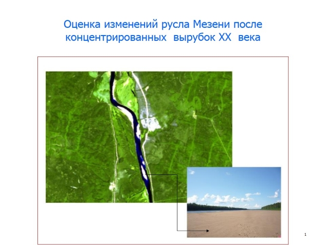
– We use different methods – at different levels. When estimating the changes in the large rivers hydrological regime, we take the objective data of the Hydrometeorological Service and Earth Remote Sensing materials as a basis. The essence of the method is that, comparing space images of the same territory made in different years, we can assess the rate at which the new logging areas appear and overgrow subsequently within one watershed of a specific river. At the same time, we can trace the changes of the runoff parameters over the same period – based on the Hydrometeorological Service data. However, this only works on adequately large rivers having fixed hydrological stations of the Hydrometeorological Service.
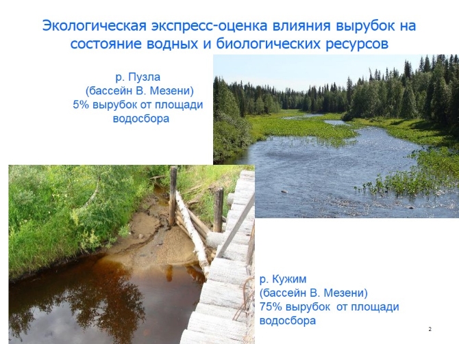
The next level is medium-sized rivers with watersheds logged in different time and to a varying degree. In this case we use bioindication methods. We are planning to see how logging affects the biological resources of these watercourses.
One more level includes small streams with small watershed, which have relatively recent logging, and it is possible to determine the changes in the watercourse, its floodplain, or on the watershed by the instrumental measuring.
It should be borne in mind, that the logging impact has not only a longterm, but also spatial nature. Logging is performed at various points of the same landscape at different times, and by different ways, which results in a gradual long-term influence and change, but not an immediate one. The reasons of the changes are often difficult to understand. When, in the early 1990s, log drifting was prohibited, many people noticed that the riffles had got sanded and the amount of fish had decreased. The common people got the impression that log drifting was useful for the river. However, the log drifting was accompanied by the dredging operations. As soon as they were stopped – the sand carry-over and redistribution process started, and it is still ongoing. People quite often mix up the cause and its consequence.
Of course, the river lives by its own laws: it forms new riffles, frets out new channels for itself, new dead channels get separated, and so on. However, deforestation accelerates and alters the natural processes on the river. Here is an example. At the end of the 19th century, the steamships went to the village Yaksha on the Pechora – the river was deep and navigable up to the headwaters. Now, during the summer low water period, it is problematic to go through the upper reaches of the Pechora even by a motor boat. These are the long-run consequences of the multi-year logging.
– What difficulties have you encountered already at the beginning of the project implementation?
A key feature of our project is that the hydrological regime of a river is affected by many factors, including climate changes, weather anomalies, construction of hydraulic engineering structures, and other types of human intervention in the natural processes. In fact, it is extremely difficult to isolate the logging impact from other influences. However, these are objective difficulties.
A separate issue and a separate research line is an assessment of erosion processes after felling. The modern machinery causes deep ruts and also gullies on the slopes. Later on, all this dirt enters the streams and rivers with further redistribution in the flood plains of these watercourses, affecting both the watercourse and biological resources. However, the assessment of such influence is made only for the spawning rivers of our Far East, Sakhalin, Canada, and America. The plain rivers have been hardly evaluated. Of course, the fact that the problem is insufficiently explored, makes the work more difficult.
– Can you you give us a brief overview of the progress over the first year?
– The pilot rivers have been selected for the research. This is the Mezen in the upper and middle reaches with the logging conducted in 1960-90s and ongoing at the present time. These are the upper reaches of the Vychegda from the source to Storozhevsk, where the logging was carried out not so rapidly and intensively, but for a longer period. Besides, these are their tributaries. In the Mezen basin – the rivers Lower Puzla, Maly Irych, Irych, Purzin, and Lupt; in the Vychegda basin – Voyvozh, Pomes, Cher Vychegodskaya, Yagcher, and Pozheg. The different forest use history on the watersheds of these rivers and availability of the long-term observation materials at the hydrological stations of the Hydrometeorological Service have become the main criteria for selection of these rivers as the pilot ones.
The watershed areas have been defined for the pilot rivers. The clear felling areas for every pilot watershed have been defined per decades, starting from 1975, using the archive of space images. An assessment of the watersheds area disturbance speed by the logging of different years (by 10-year periods) has been carried out for the “pilot” rivers in the Mezen basin. We plan to match the obtained data with the changes of the hydrological parameters of the river Mezen on the hydrological stations Makaryb (the Upper Mezen) and Bolshaya Pyssa (the Middle Mezen). The data processing is ongoing.
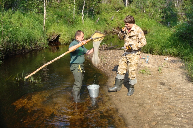
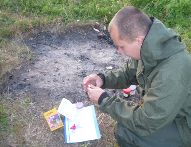
In July – August of the last year, the expeditions aimed at the ecological rapid assessment of the logging impact on the condition of the pilot rivers water and biological resources were organized. In the course of the expeditions, physical and chemical characteristics of the watercourses surface waters have been assessed. The conducted study was of a reconnaissance type so far, but we are planning to conduct a more detailed research with taking more samples.
Besides, an analysis of the national and foreign scientific literature on the forestry and logging impact on the water regime of the rivers and watersheds has been carried out. On the basis of this analysis, a corresponding analytical survey, currently placed on the Silver Taiga Foundation website (www.silvertaiga.ru) for the interested users, has been prepared.
– During the conversations, local residents very often give quite a clear estimate to the logging impact on the condition of the river and its resources. Will the research results be somehow related to the assessment of the local residents?
– Yes, the assessment by the local residents and, above all, the old-timers is very important for us, if only because they have been watching the river and its changes for many years. Especially since there is no hydrological observations data over a long period of time, there are breaks in the data collection on certain rivers. We are planning to conduct surveys of the local population, in order to assess the changes of the “pilot” rivers environmental characteristics, including the fish resources condition, over the longest possible period (30, 50, perhaps 70 years).
– Yury Anatolyevich, judging even by your brief summery, the objectives and volume of work, appear to be high. Who is engaged in the project?
– First of all, these are our employees – the foundation ecologists Alexandr Borovlyov, Nikolay Shilov, and Nikolay Shuktomov; and, of course, our partners. We collaborate with the Institute of Biology of the Komi Scientific Center, the Ural Branch of the Russian Academy of Sciences, Hydrometeorological Service, and FSBI “Komirybvod”. We use forest management materials, various historical data, materials of the same or similar projects conducted in other countries and regions (for example, the reports of the WWF project in Sakhalin, Canadian project on the Miramichi river, etc.) As the project implementation is progressing, we will also involve other materials and experts from other organizations.
A review of the literature on the subject under study “Assessment of a long-term logging impact on the water resources” RUS ( PDF | 320Kb)
The interview has been taken by Valentina Semyаshkinа
Translated by Irina Sokolova


